 Collection of Figures and
Animations
Collection of Figures and
Animations
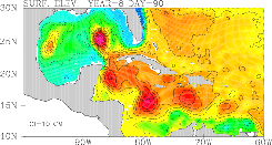
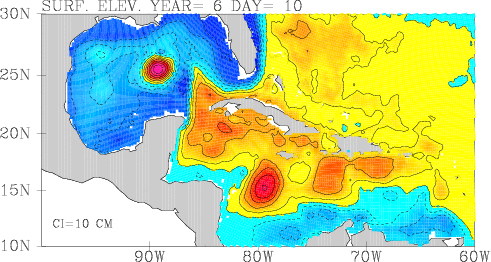
Gulf of Mexico, Yucatan Straits and Caribbean Sea
Simulations with the Princeton Ocean Model
(Supported by ONR & MMS)
Collection of Figures and
Animations
Animations:
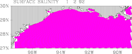
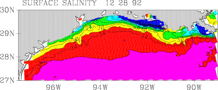
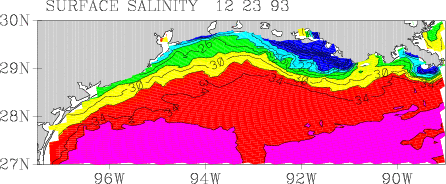
Surface Salinity on the Northern GOM Shelf: 1992 , 1993 , 1994
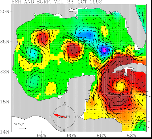
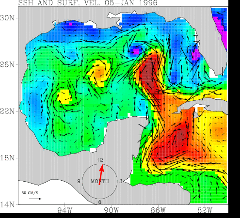
SSH and Geostrophic Vel. from Altimeter data: 1992-1995 (9mb gif) , 1996-1999 (12mb gif)
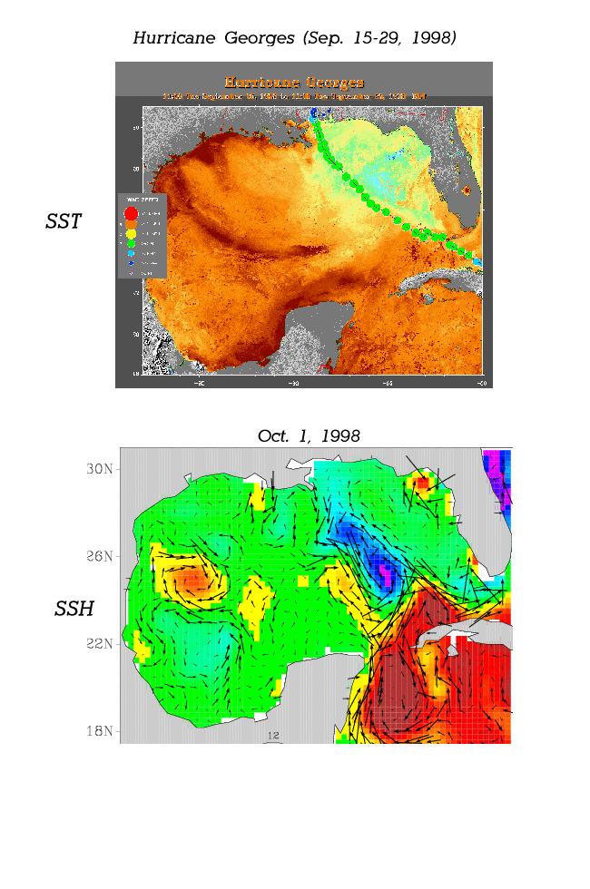
Effect of Hurricane Georges on SST and SSH
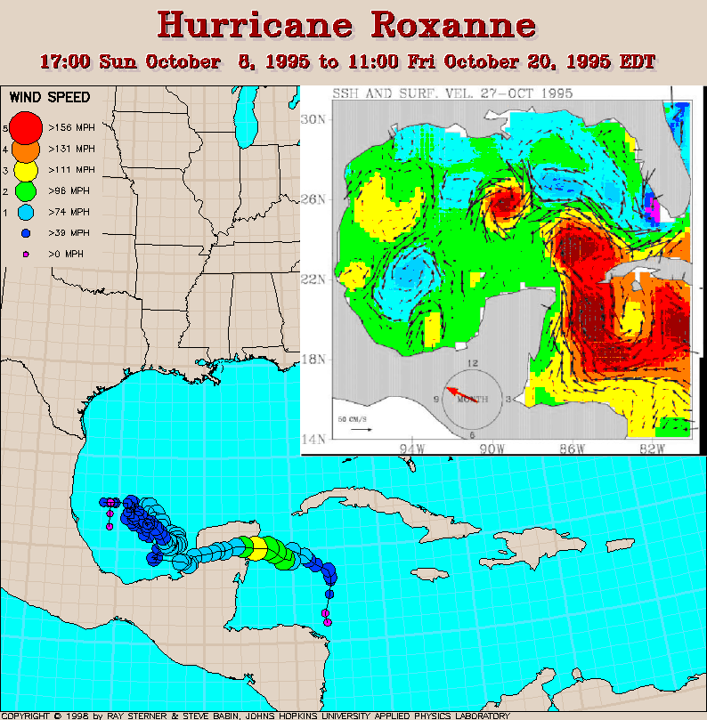
Effect of Hurricane Roxanne on SSH
Simulation of GOM Loop Current eddy shedding (7mb gif)
Yucatan Strait FlowReferences:
Most of the results obtained from a North Atlantic model (5N-50N), forced by monthly COADS climatological surface data; the model configuration is described in:
Ezer,T., On the seasonal mixed-layer simulated by a basin-scale ocean model and the Mellor-Yamada turbelence scheme, J. Geophys. Res., 105(C7),16,843-16,855, 2000.
Ezer,T. and G. L. Mellor, Sensitivity studies with the North Atlantic sigma coordinate Princeton Ocean Model, Dyn. Atmos. Ocean, 32, 185-208, 2000.